IGI involved in forensic petroleum geochemistry research
IGI’s Marianne Nuzzo is a co-author on a groundbreaking study led by Dr.
 
                
                Seep biogeochemistry & organic geochemistry
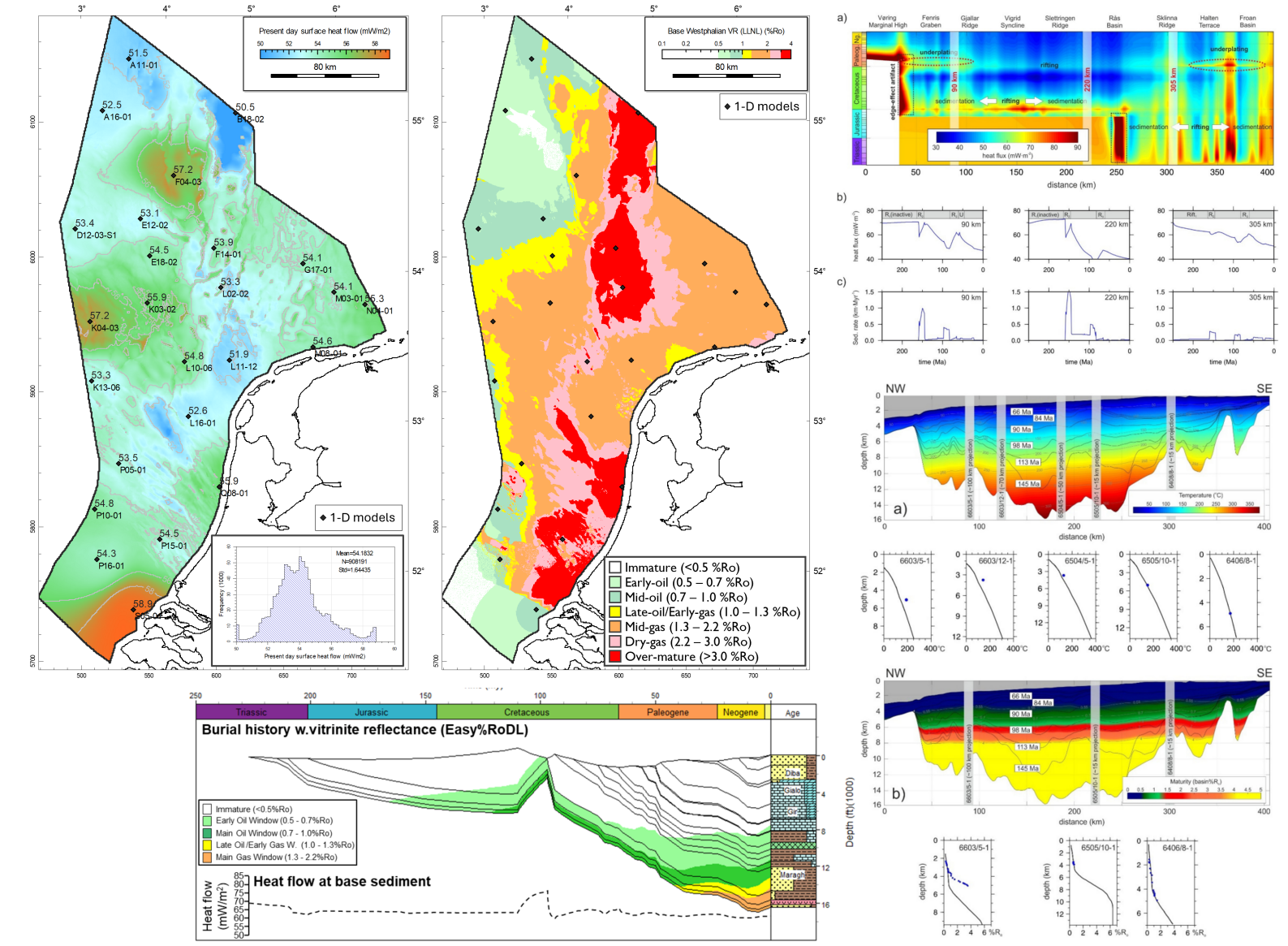
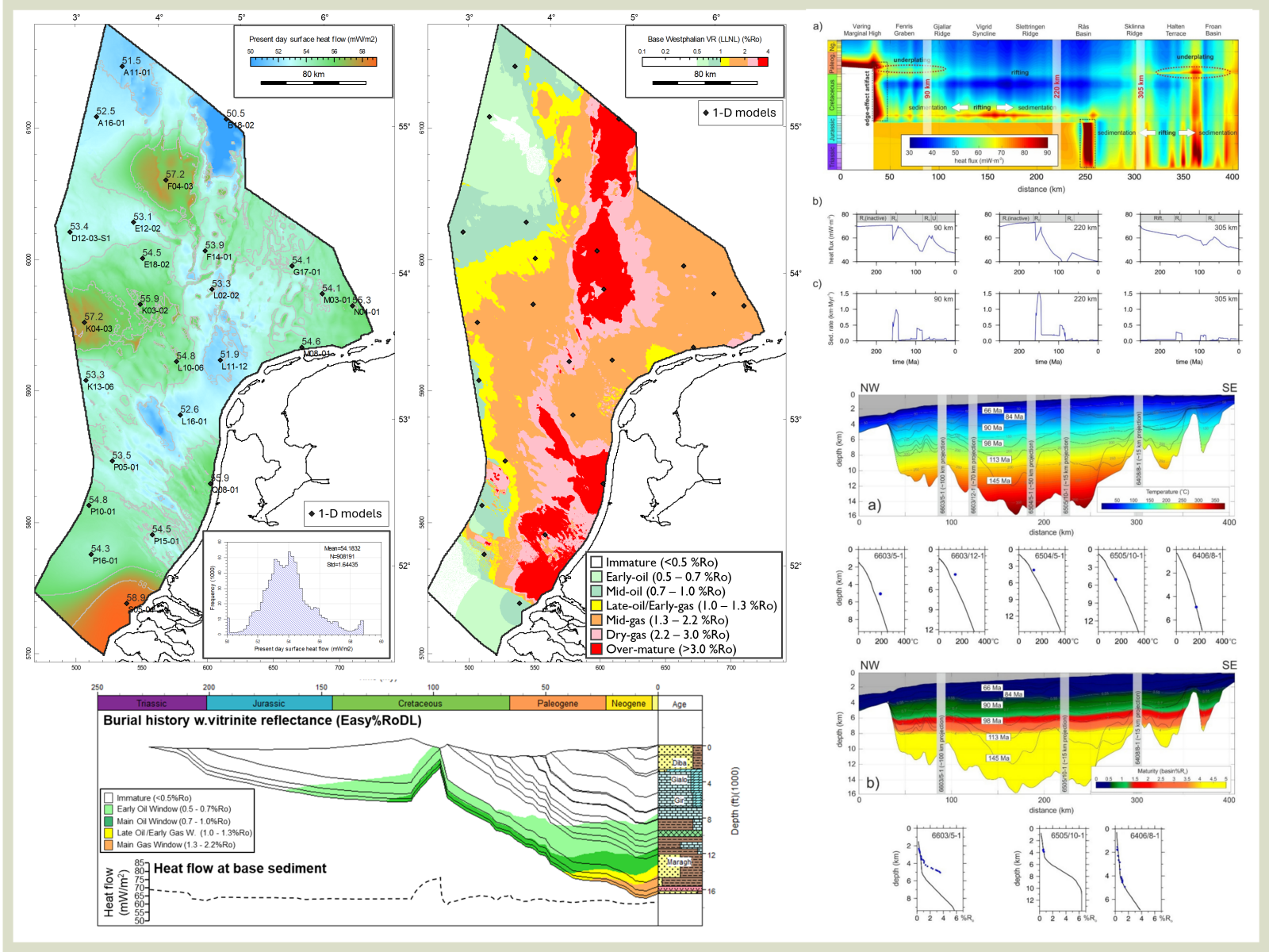
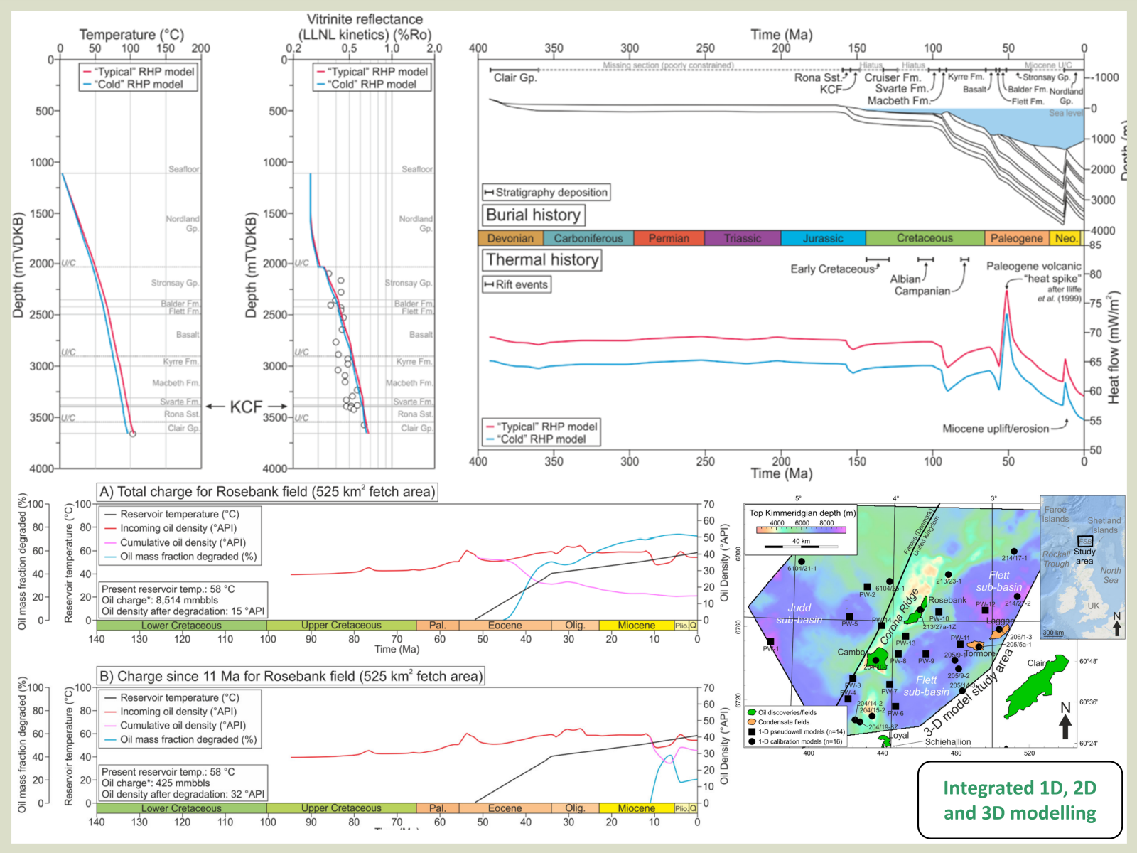
Fully integrated 1-D, 2-D and 3-D Basin & Petroleum Systems Modelling, providing a highly powerful, iterative and cost-effective solution to address subsurface uncertainties
 
        
    Key features
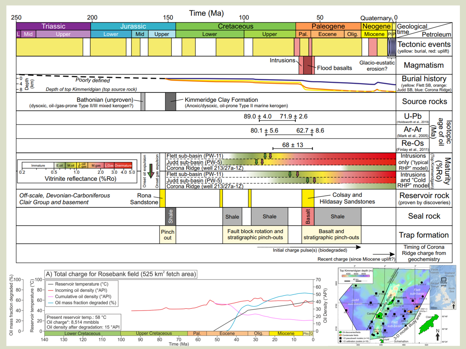
BPSM utilises key aspects of geological, geophysical and geochemical interpretation into a unified, integrated subsurface model. Depending aims/objectives and data availability a bespoke workflow will be proposed
Coupled thermal-burial histories are fundamental to BPSM, integrating tectonic, sedimentological and fluid properties, calibrated to temperature, pressure and palaeothermometric (e.g., vitrinite reflectance) data
Quantifying the magnitude and timing of source maturity, and predicted hydrocarbon volumes and phase
Provides critical understanding to source rock maturity, reservoir quality & seal effectiveness
Modelling of reservoir charge volumes/phase/timing, migration and alteration processes
Discrete scenarios (e.g., migration) or Monte Carlo Simulations (e.g., expulsion volumes in fetch area, PVT prediction of reservoir fluids)
IGI’s Marianne Nuzzo is a co-author on a groundbreaking study led by Dr.
 
                
                Seep biogeochemistry & organic geochemistry
By Paul Farrimond
Oleanane is present in only some oils and source rocks. It occurs as two isomers – 18α(H) and 18b(H) – and is typically found as a doublet peak in the m/z 191 mass chromatogram eluting just before the C30 αb hopane.
 
                
                Director & Technical Advisor
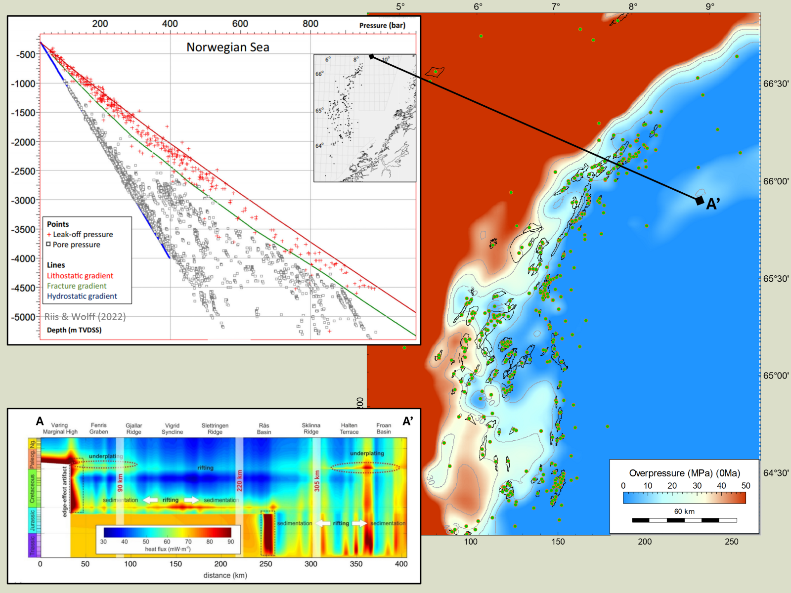
The paper, in collaboration with @ Petrostrat and @ Geocosm , is entitled: “Under pressure: using basin models to help predict reservoir quality in the Garn Formation in the Norwegian Sea”
 
Focussing on the Middle Jurassic Garn Fm.
 
                
                Consultancy Manager, Senior Geochemist & Basin Modeller
Dedicated experts who have worked in all tectonic settings (e.g., passive margins, igneous affected sedimentary basins, thrust belts)
 
                        From regional/bulk data (e.g., heat flow, oil density, GOR) to high-precision analyses (e.g., biomarkers), IGI integrate all available data to build a comprehensive subsurface model
 
                        Access to ZetaWare (Genesis, Trinity T3 & Kinex), Platte River BasinMod, SLB PetroMod, Migris, Geomodelling Solutions TecMod-2D
 
                        Basin modelling has uses across oil and gas exploration, production, geothermal, CCS, hydrogen exploration
 
                        Common questions
Source potential is a function of many factors, including (but not limited to) organic content, kerogen type, maturity, expulsion efficiency & thickness, all of which vary temporally and spatially. When properly integrated with calibrated basin models, the petroleum generation/expulsion volumes and phase can be predicted
Integrating source maturity through time, migration routes (e.g., fault seal), reservoir properties, PVT conditions and alteration processes (e.g., biodegradation) allows an estimation of prospect volumes and phase in both deterministic scenarios and stochastic uncertainty analysis. If in a mature basin, calibration to neighbouring discoveries is critical
IGI's workflow always includes risk & uncertainty analysis with distributed ranges of input parameters (e.g., TOC, geothermal gradients), dynamically showing which elements are most sensitive to predicted charge volumes and phase
Coupled thermal-burial histories are fundamental to BPSM, integrating tectonic, sedimentological and fluid properties, calibrated to temperature, pressure and palaeothermometric (e.g., vitrinite reflectance) data
For most projects, even building a grid-based 3-D model is a relatively efficient process, providing impactful and powerful results in what is usually a fraction of the time taken for seismic and geological interpretations
Project deliverables include key outputs (e.g., digital maps for GIS/Petrel). Modelling files are also included to be updated as and when new data become available