p:IGI-3

p:IGI-3 - IGI's proven geochemical data interpretation tool
p:IGI-3 is the operational release of our geochemical software, designed and engineered in-house for optimal data organisation and interpretation of all kinds of petroleum geochemical (and supporting) information. Developed over the last 15 years, this package enables geoscience professionals to use screening, molecular and isotopic geochemistry for well, acreage, prospect and basin scale evaluations.
p:IGI-3 comprises an expanded geochemical data structure, alongside a dynamic multidimensional visualisation and interpretation tool with elegant graphing capabilities. The software includes an extensive menu of pre-built industry standard plots, most of which have interpretational overlays to guide the user. The data format is both standardised and highly flexible, with both pre-defined fields benefiting from interchangeable units and ratio formats and user-definable fields. The user can quality assure their data using inbuilt tools, and easily create and modify interpretational plots of various types. The software comes with an IGI compiled World geochemical database built from open literature for project data comparison, and a series of maps. Both software and geochemical help facilities are included.
The geochemical database structure within p:IGI-3 has 687 pre-defined columns, arranged over 17 linked data pages. An additional 300 user-definable columns allow the user to enter any numeric (including equation) or text data that are not standard within p:IGI's pre-defined columns.
If you are interested in getting more information, or a WebEx demonstration of p:IGI 3 please contact us using the button below.
Contact us for more information about IGI software
Fill in the form to get in contact
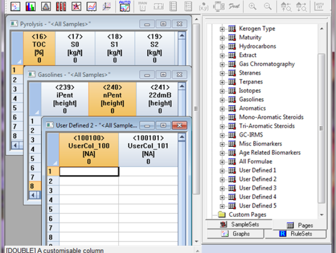
A data format which is simultaneously standardised and highly flexible, with both pre-defined and user-definable fields
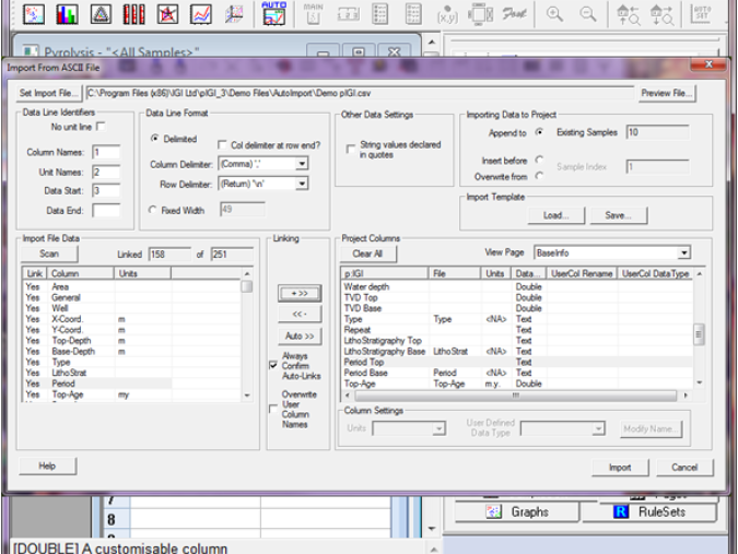
Smooth data import with both manual and semi-automated data linking. Import linking templates ensure efficient loading of repetitive data formats
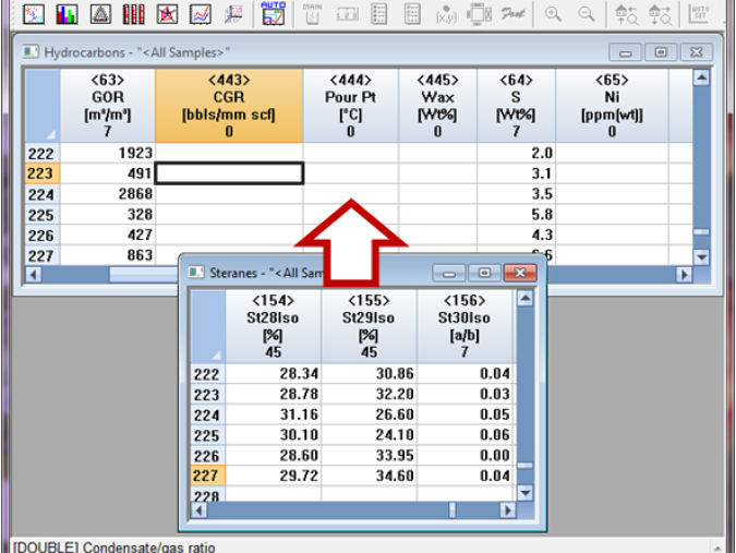
Data merge between projects to ensure no duplication during project constructions
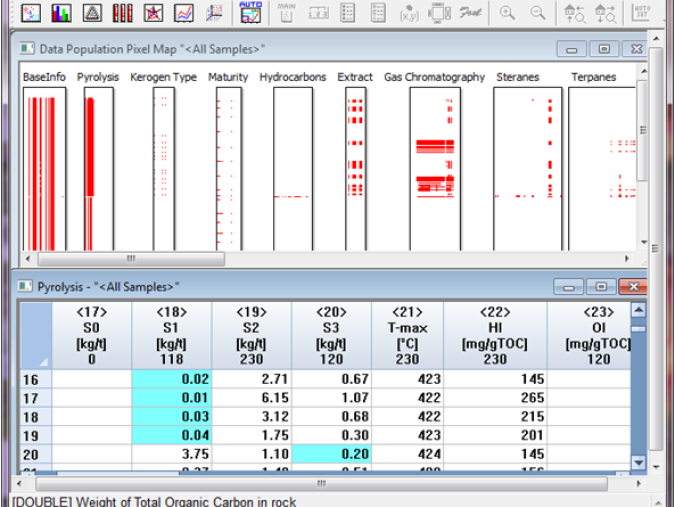
Intuitive data quality control with project data overview and geochemically smart spreadsheets
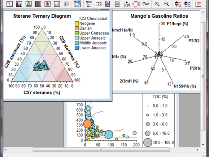
Elegant graphing capability with palettes by colour, shape & size to aid interpretation
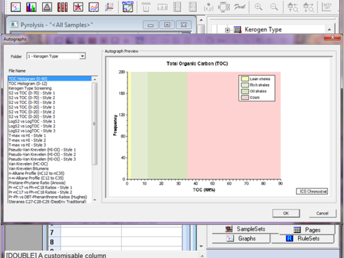
Extensive menu of industry standard autographs, accompanied by interpretational overlays to guide the user
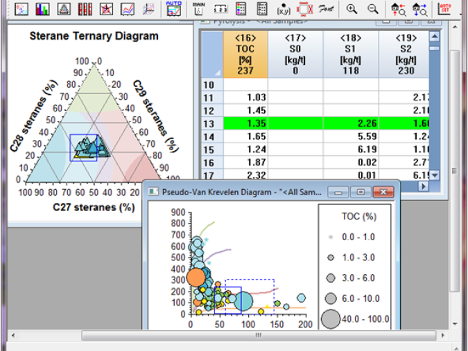
Dynamic data investigation with multi-data select across graphs and spreadsheets and visual query
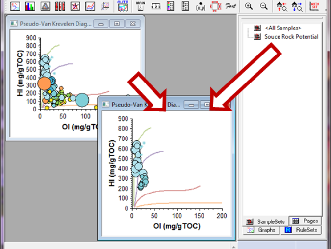
Sub-division of geochemical data into sample sets enabling effective overview and comparison
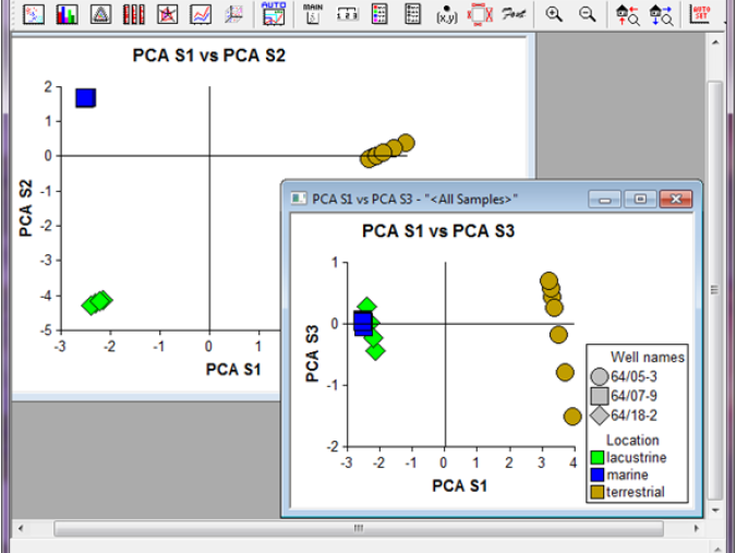
Summary and advanced statistical investigation of data, including a PCA software module
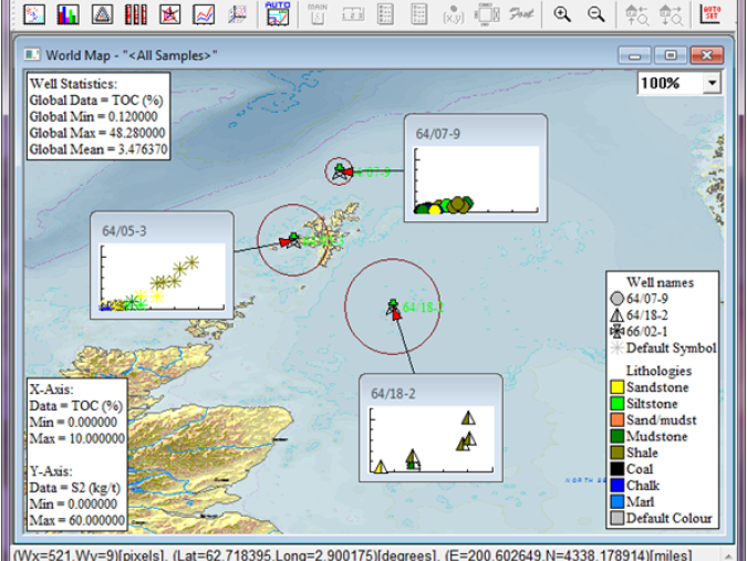
Extensive bank of world and regional maps for spatial data plotting and statistical review
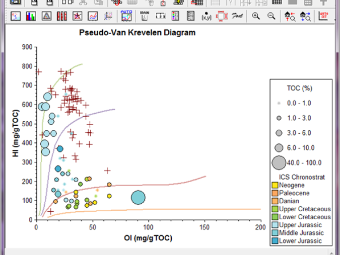
A worldwide public geochemical database with the ability to compare to your project data through 'background data'
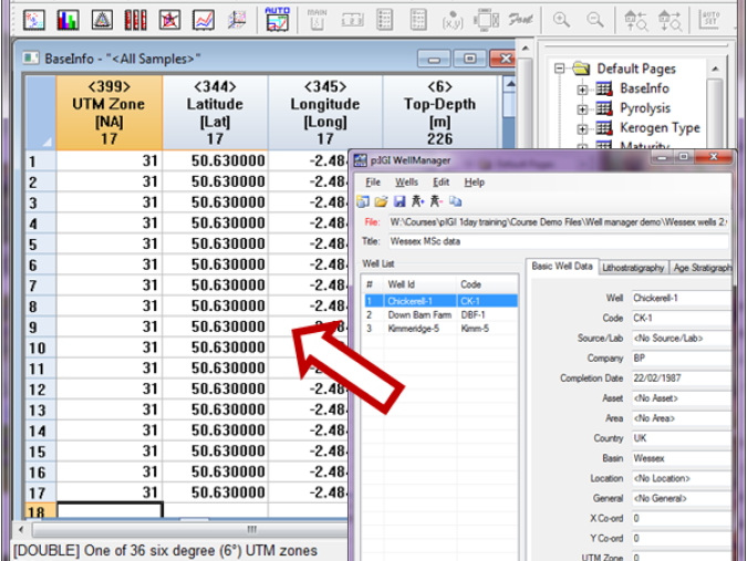
Well metadata management conducted through external module. Facilitates auto-population of sample data
System requirements
Operating systems
p:IGI-3 Supports the following operating systems:
- Windows 2003
- Windows 2008
- Windows XP 32bit and 64bit (Service pack 1.0 or higher recommended)
- Windows Vista 32bit and 64bit
- Windows 7 32bit and 64bit
- Windows 10
System Requirements
- p:IGI requires the .NET framework version 3.5.1
- Processor: 400 MHz Pentium processor or equivalent (Minimum); 1GHz Pentium processor or equivalent (Recommended)
- RAM: 96 MB (Minimum); 256 MB (Recommended)
- Hard Disk: Up to 500 MB of available space may be required
- CD or DVD Drive: Not required
-
Display: 800 x 600, 256 colours (Minimum); 1024 x 768 high colour, 32-bit (Recommended)
- Windows server 2008, 2008R2 or Server 2012 is recommended for the SentinelRMS License software included with p:IGI-3.
